Prattle & Jaw

Two blogs about a whole lot of nothing

Filtering by Category: Holidays

Canyon De Chelly to Alpine

I can’t really believe I’m still in Arizona right now but I’ll get to that.

I wake up at 7am on the dot. I’ve slept well and I can just peek the blue sky outside. It’s a bit of a luxurious morning – I don’t really have to leave until midday so I loll about in bed for a bit with Ellen (not the talk show, the original Ellen) on the TV. I’m surprised when it makes me laugh out loud. It was a really good show.

I roll out of bed, shower and hit breakfast for some eggs and toast, then have a look at the gift shop. I really want to get a book about the Navajo but they’re very, very expensive, as gift shops often are. I’ll have to check on Amazon. I head back, change and check out the pool for an hour or so. I read my book about the Glen Dam, have a dip, then get itchy feet and leave at 11.10.

It’s a lovely day, but there are clouds in the distance. I’ve only got two hours until I reach the Petrified Forest, something I’m not quite sure about, but it’s en route and I’ve heard it’s good so what the heck. I’m driving on the highways today. I must admit it’s a relief. I know where I’m going (the GPS is over our dispute and is telling me the truth), and it’s smooth. The highways around here are just two lanes – one in either direction. I’m glad it’s no bigger. I learn to appreciate roads on this trip. After an hour I reach the Hubble Trading Post, established in 1870 as a trading post and all-round gossip sted for Navajo, Hopi, Auni, Acoma, Pima, Tohono O’odham and Apache Indians. If you’re wondering, John Hubble of the trading post is a relation of Edwin Powell Hubble, of Hubble Telescope. It’s a fantastic group of buildings. I wander around and look at old stuff. I love it. I buy an ice-cream.

Then it’s back to the road. It doesn’t take long to hit the Petrified Forest, but first I decide to go the back route instead of via the highway but regret it the moment I turn off. It’s dusty and bumpy and God only knows where I’ll end up. Turns out I end up on a railway line, the Santa Fe railway line (the same one that rides through Flagstaff). On the other side, the road turns private so I have to turn back. Oh well.

First off, I ride through the Painted Desert. I’m literally the only person here. I put it down to holidays being over and the fact that the weather is grey and windy. But it’s still beautiful and most odd.

Only me

Turning back on myself, I stop on Route 66. Alongside the highway, old telegraph poles mark the original route of 66. There is a beautiful rusted car to commemorate it. I stare down the telegraph poles (you can just see them to the left of the car) and try to imagine it. I wish I could go back in time, ride that route and get my kicks.

Instead, I head to the Petrified Forest. I’ve no idea what to expect, but am pretty much instantly impressed. Again, I’m just about the only person there so get to stand alone on the viewpoints and jump over stuff when I want to.

It’s beautiful.

Back in the late 1800s and the early 1900s, people came here, from Route 66, and took what they wanted. There wasn’t all that much left when it was established as a national park in 1962.

The short of the long is that around 200 million years ago, there was a forest here. Trees fell, and were covered in all kinds of stuff. Decay was slowed and stopped, and silica-laden water seeped through the wood and replaced the original wood tissues with silica, thereby petrifying the wood. As the ground was eroded many, many moons later, the trees were uncovered, and would fall and break into log-sized lumps. And here we are.

First off I visit Newspaper Rock, so called as the rocks are covered with petroglyphs, just like the ones at Glen Canyon. There are a few other people peering over the edge, and an elderly park ranger who is all too willing to lend me his binoculars. They’re incredible to see up close, as it were. There are all kinds of carvings, animals, hoof prints, people, and so much more. We all talk about them and what they mean. Park Ranger says that various Indian tribes would travel along the once big river that was here, and would leave messages in the stone, probably along the lines of how good the hunting was, or who had been past here and when, that kind of thing. It’s fascinating. Zoomed in here so you can see them more clearly.

I work my way through Blue Mesa and petrified wood. It’s quite remarkable. 

The chippings and some of the petrified wood look as if you could just pick them up and lob them on the fire, but to the touch, they are nothing but rock. It’s fascinating and I’m surprised at just how fascinating I find it. I’m tempted to nick a bit but don’t. I must have grown up.

It takes about 2 hours to do the park, and I’m very happy with it.

This sign catches my eye on the way out and I buy a big lump. They only had Bud so I didn’t buy beer.

I discover that it’s just under 2 hours to Alpine which is good news. I thought it would be much longer. I’m in a great mood and head out.

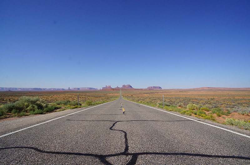
US highway 180 is the longest straight road I've ever been on. It just goes on and on and on.

For over an hour and a half, I don’t see a single car. No joke. It’s just me. I actually start to wonder if there’s something I don’t know about, when I finally see someone else. The last time I was on a road so deserted was in 1999, in Texas. Back then, you’d flash your lights or wave whenever you passed a car. It was like being in a club. I think of the bazillion bikers I’ve seen on this trip and how they always acknowledge each other. I’m a bit jealous whenever I see this. I try to wave at the first car I pass, knowing that they can’t have seen a car for a pretty long time either, but I’m not sure if they wave back.

The rain clouds in the distance look threatening, and it’s not too long before I reach them and they break. It’s pretty nice. It rains and rains and I wind my way up to 9000 feet. With every minute I’m leaving the heat behind and seeing more and more pine trees. Suddenly I’m high up, and surrounded by trees and green stuff. The air is cool and smells of pine. I’m not entirely sure where I’m going, but I know the name and I should pass a sign at some point. There are hardly any cars on the road.

Every building I pass is made of logs. It’s how I imagine Canada, not Arizona. I roll into Tal-Wi-Wi lodge just before 6. Perfect. They have a room, log, of course, and I am so excited about it. It’s very, very quiet and there are deer in the field opposite me.

I sit outside on my balcony, and look at the view. It’s pretty chilly so I put on jeans and head to the saloon for some dinner. I meet one of the owners who is Welsh, of all things. We talk about Alpine and how she thinks it’s the most beautiful place in Arizona. It’s probably one of them.

I eat my dinner and read a paper that has stories about the history of Phoenix and an Oglala Sioux warrior called Red Cloud. On the way back to my room I use the paper as shelter from the rain that has started again.

Back in my room I’m already looking forward to seeing the outside in the daylight – hopefully without rain but I won’t be too bothered if it is wet. It’s a change.

No AC tonight. Nothing but peace and quiet. Tomorrow I head towards White Sands, New Mexico. Last time I was there I saw a Stealth Bomber fly over. I’m crossing my fingers I’ll see the same thing again. 
Monument Valley to Canyon De Chelly

Interesting day today. Not quite what I had expected.

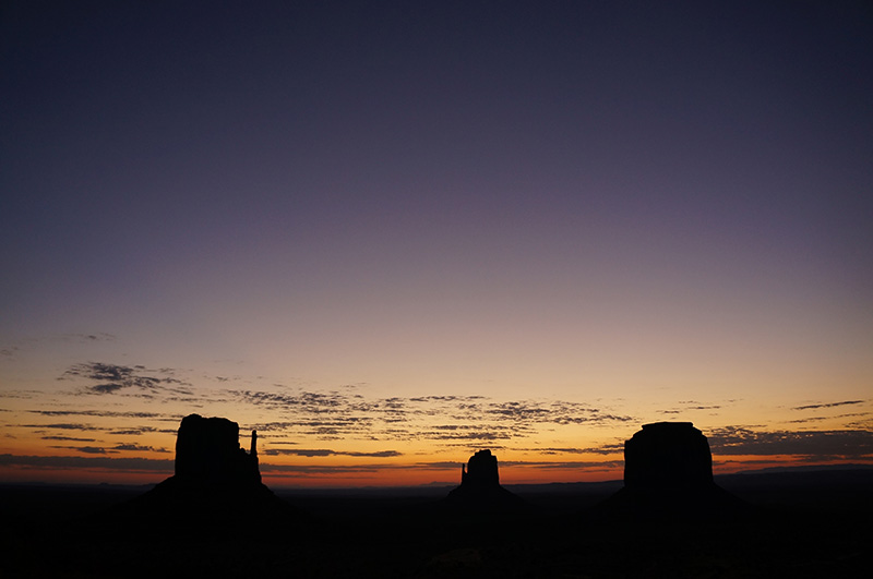
It started well with another beautiful sunrise over the valley.

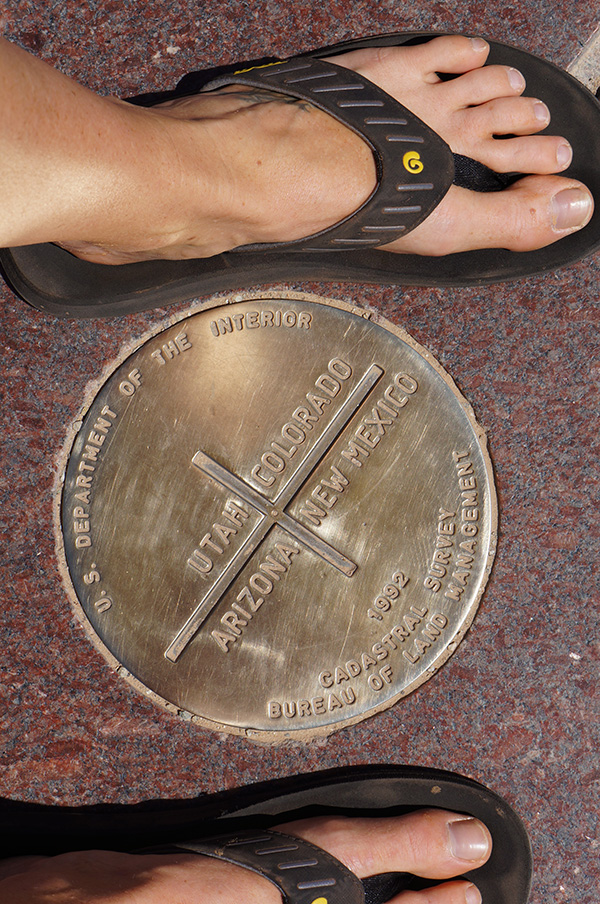
I ate breakfast (bacon sandwich!) then sat online for a short while before heading out to fill the car up and make my way to Four Corners, a landmark in the Navajo nation that sits right on the junction of Arizona, New Mexico, Utah and Colorado. The idea was to leave the highways behind and hit the back roads once again. The route is mentioned in Lonely Planet and is described as, in dry weather, suitable for a two-wheel drive sedan.

It’s not.

I’ve got the route marked on my huge Arizona map book, which features all the unpaved roads, dirt roads and so on, and I’ve also got the very basic, quarter page description in Lonely Planet, although that doesn’t help at all.

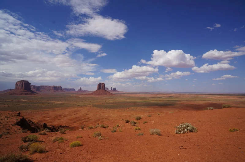
I leave Monument Valley slowly, taking in as much of it as I can, and fill up with petrol. For some reason the flow doesn’t stop automatically and petrol flows over the outside of the car. I wonder if this is a problem but am fairly sure it’s not. I head out and leave the valley behind me. It’s the classic view. I consider myself lucky to have been there, but know I'll be back.

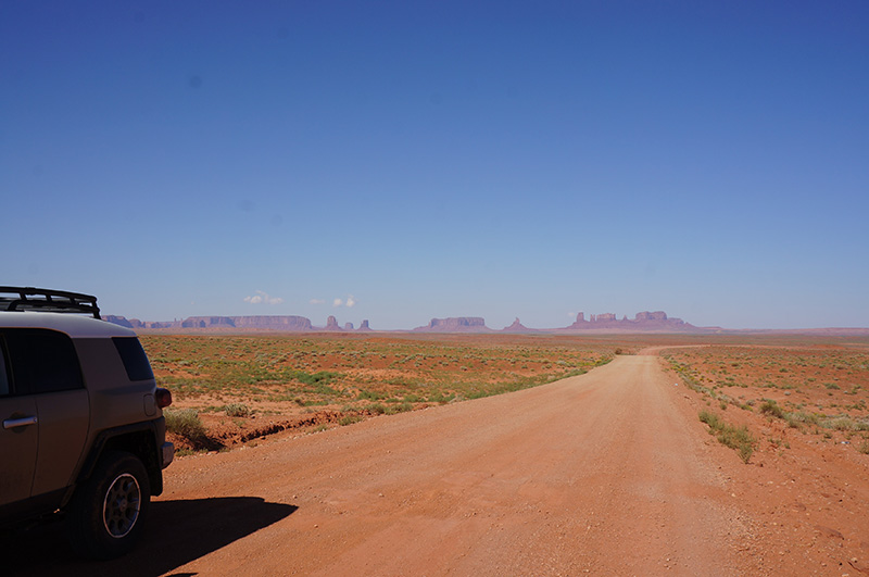
I’m looking for a road that isn’t marked, and take a guess. My GPS says I guessed right, I think. I see a road marker, and I’m on the right road. The soil is beautifully red and I’m the only car in sight. Monument Valley is stretched out beside me and I’m very happy. The road is flat and just the right amount of dusty to throw up a very picturesque cloud behind me. It’s easy going.

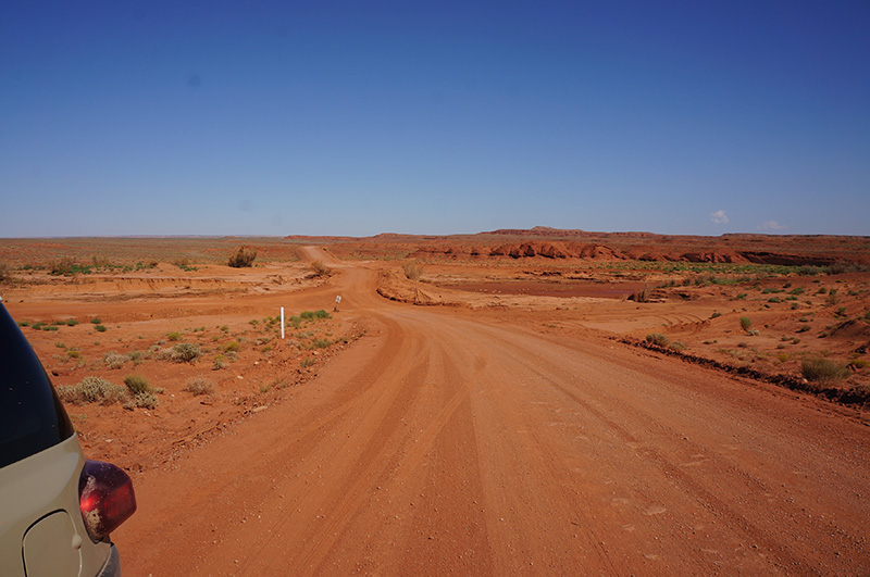
It gets worse. The sand gets deeper and there are some pretty big bumps. Thankfully no mud. I go slow and it’s OK.

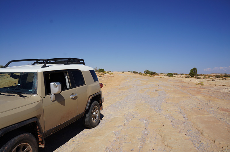
But then I think I’m lost. My GPS keeps wanting me to go back to the highway and I keep ignoring it. I see wooden road markings and I’m sure (ish) that I’m on the right path. I seem to be driving for much longer than I expected. I start climbing up and up and realise that I’m driving up Comb Ridge, and Monument Valley is splayed out below. I’m still the only car and it feels so wonderfully private. The description in Lonely Planet mentions driving up the ridge, so I feel confident I’m on the right path. GPS catches up and yes – it’s all good. I’m feeling good and plough on. But then things get funny again. The GPS tells me to turn when there are no roads. I presume they’ve been washed away or even blown away for that matter. I push on. I get to the top of a large hill and after going over some very, very rocky ground, find myself on a huge flat expanse of rock. There’s no road. I back up. I think I saw another track a short while back. I turn down that road and after a minute end up in exactly the same place. This is the moment I start thinking I’ve made a mistake. I have reception on my phone, an apple, and about a litre of water. The GPS says I’m just 6km away from a highway, so why can’t I see it or hear it? There is absolutely nothing around me. I get out of the car and walk about. I walk forward about 50 metres and see what could be a track. I’ve got nothing to lose so move very, very slowly over the rock and down the track. After a few minutes and lots of ‘recalculating, recalculating’ the GPS catches up and yes, I’m on track. But it’s not an easy track. Deep, deep sand and huge rocks litter the way and I inch forward. Suddenly, out of the corner of my eye, I see something flash. It’s the sun reflecting off cars. My heart jumps and I am very, very relieved. I tell myself that there will be no more back roads.

What road?

As I hit the tarmac, I eat my apple and gulp down water in celebration. I know wife and mother won’t be impressed with latest adventure so feel guilty. The drive that I expected to take an hour or so, had taken three, but not too much longer. I look forward to getting out of the car and visiting Four Corners.

I visit Colorado. It’s my first time in the state and it’s quite nice. 

There’s not much at the monument, so I get back in the car and head towards Ship Rock, an almighty rock in the middle of nowhere that really doesn’t look like it belongs there. For some reason I don’t take a photo and just move towards Canyon de Chelly. My GPS has the hump with me and keeps trying to take me in odd directions so I turn her off. My map doesn’t help as I’ve only got Arizona and now I’m in New Mexico. I feel oddly uncomfortable not having a guide of any sorts.

I don’t feel better until I’m back in Arizona and can look at my map. Ah, paper maps.

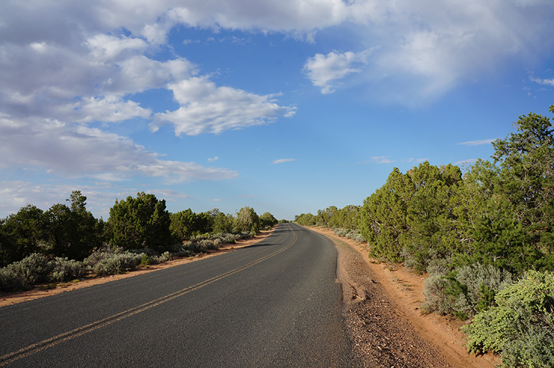
I drive and drive and drive. I go up, and up and suddenly I’m surrounded by green and the sweet smell of flowers. The air cools and the road curves and curves almost back on itself until I reach the top. It’s a completely different place. Hard to believe it’s Arizona. It’s almost Swiss. Then I go down, and down and it starts to look more like the Arizona I know.

Finally, I see the first signs for Canyon de Chelly.

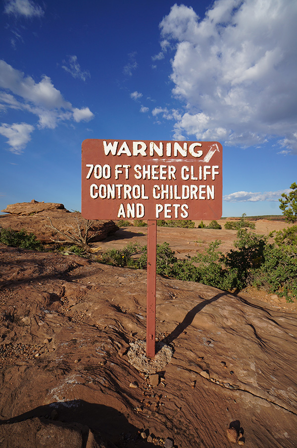
I take the north rim drive in, and pull over to look. It’s an incredible view. Like no other canyon. Huge, but small enough to grasp. I strike up conversation with a Navajo couple who are selling jewellery and composing flute music. We talk about the culture and the pride. I tell him how angry it made me to learn about the vote and citizenship issue, and he talks about his grandparents, and the history of his people. It’s passionate and sad, and I want to know more. He tells me I look like Macaulay Culkin and I make my exit.

I head on through winding roads and finally end up at the visitor centre, and a small hotel which thankfully has a room. I check in, then head back out to do the longer south rim drive. I start from the far end and work my way back.

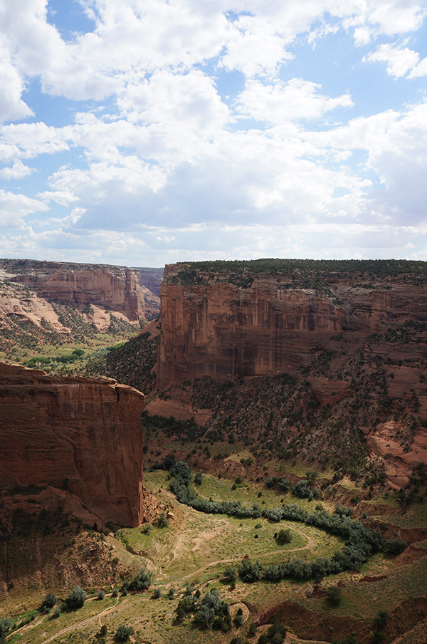
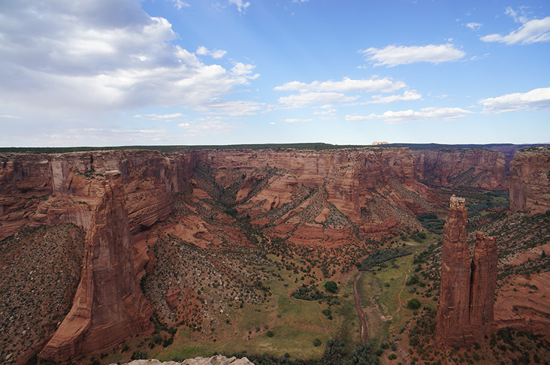
What a stunning canyon it is. The floor is so green, almost European, it’s easy to imagine people farming and living there – although it doesn’t take a lot of imagination as Navajo families still do live there and work the land. It’s beautiful.

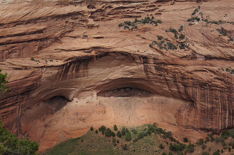
If you look closely at the middle of the photo you can see houses built directly in to the walls of the canyon. Remains of similar dwellings dot the canyon. They must have been so sure-footed.

I work my way down the rim drive, and am really quite entranced by the beauty and silence of the canyon. I only see about 6 other people the entire time. It’s so peaceful. Why more people don’t visit, I don’t know. I can’t decide if it’s a good thing or a bad thing. It’s a place you could spend a lot of time. The mouth of the canyon is just by the visitor centre, so it’s no problem to imagine the first people wandering in, past rock walls of just 30 feet, going deeper and deeper until walls 1000 foot high surround them and the valley floor. Water, grass, trees, animals and birds – it’s verging on tropical. Life must have been beautiful. You know, until the Spanish and US government. 

I’ve not eaten since breakfast and suddenly realise I’m about to die. I head back to the hotel and inhale some food. The waitress calls me ‘hon’ the whole time.

I’m in my room by 8pm and thrilled about this. I get to have a couple of hours doing nothing in bed. I feel like it’s been a long, long time.

Tomorrow I head to the Petrified Forest and on to Alpine. I hear they have excellent pie. 

Monument Valley

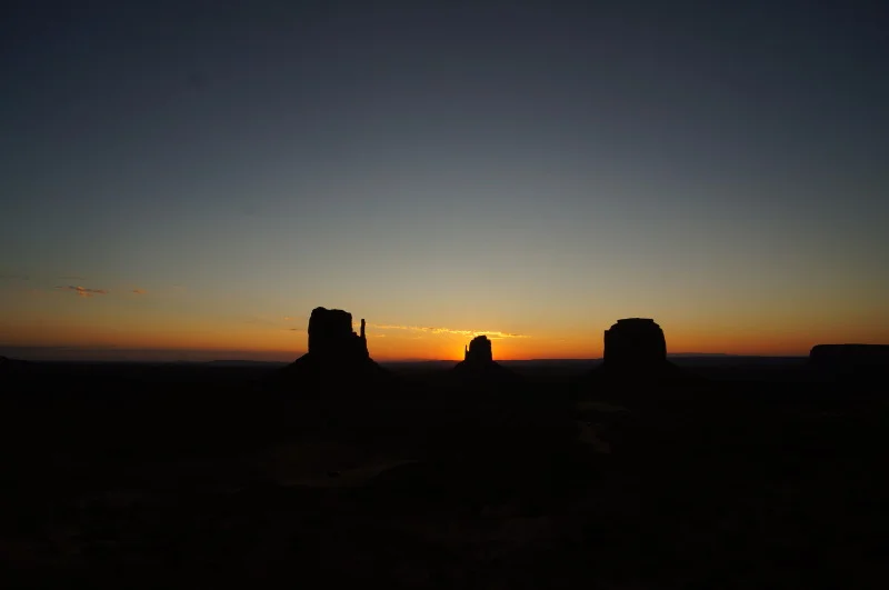
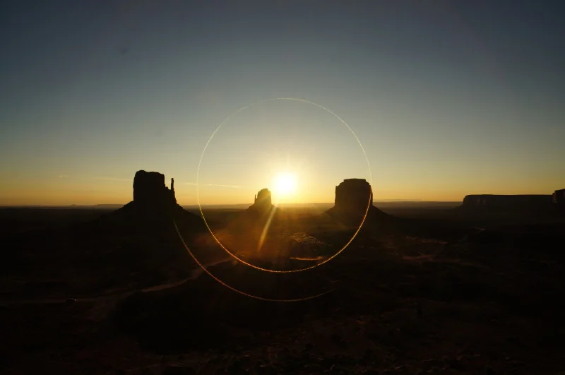
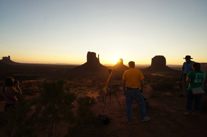
I woke up to my alarm going off at 6am. Been a while since I slept the whole night through. It was lovely. I get up, change, and head outside. Not sure where to stand but there’s a wall and I sit on it. The light is just about changing over the horizon, and it’s quite beautiful. Slowly but surely more join me, although I wasn’t the first out there. It always amazes me how quickly the sun rises. You can literally see it moving – every second is different. The sun finally pokes her head above the edge at around 7am. Warmth, light and all those sorts of things. Once again I think how easy it must have been for people to believe in some kind of higher being.

Almost-sun-up.JPG
Sun-up-over-Monument-Valley.JPG
Photographers-at-Monument-Valley.JPG

I peel away and hit breakfast then go online for a bit. I can’t decide what to do. Do I do the drive around the valley or the hikes? I settle on the hikes – probably better to do earlier before the sun really bakes everything. But first of all, I head down to the visitor centre, about a mile or something like that, outside of the park. Just outside the parking toll booths, I see a hitchhiker. I stop. After all, I’m only going to the end of the road – not a lot of time for murder and rape. He’s a Navajo dude who works at the hotel and is off to the other lodge to do his laundry. We chit chat about work and the country, and then I drop him off at the junction.

Lonely Planet says that the visitor centre of Monument Valley is appallingly useless. They are correct. It’s a huge building with next to nothing in it. It’s as if it’s still being furnished, but it’s not. I do get what I come for – a leaflet about the hike I’m about to do.

Back up at the booths, I wave my parking pass and the woman thanks me for picking ‘their little hitchhiker’. I feel like it’s going to be a good day.

I put on my Vibrams (I only have them or flip-flops), pack loads of water, butter myself up with sun lotion and head out. It’s described as ‘easy to moderate then strenuous’. So a bit of everything. They were right. It’s already hot, but it’s extremely exciting to be heading down, on foot, in to the valley. The West Mitten, which I will be walking around, is nothing but monolithic.

Rock-like-butter.JPG

Looks oddly soft

Again, I can’t imagine the scale. Passing by huge rocks, I try to imagine how big the ones far further up are, but I can’t. I read somewhere that the monuments are around 1 km tall, which is around the same as Glen Canyon and I’m just as lost when it comes to trying to imagine how I’d look right up there next to it. There’s clearly been a lot of rain – there are cracked riverbeds that look as if they’ve recently seen water, and crevasses in the sand and dirt all over the place. I’m constantly worried about running across a Rattlesnake. I don’t though.

I find a tree and hide under it for a bit. It’s amazingly quiet and I’m completely alone. Something quite unique.

Me-in-Monument-Valley.JPG

I push on. As I round the corner I realise that the Mittens are quite flat. They look almost as if they're cubes, but they’re not. They’re great slices of rock. You only ever see them from the front (or back), so to discover they’re very narrow is a great surprise to me. It’s getting hotter and I’m quick to get out of breath. I put it down to the fact that I’m almost 6 km above sea-level, but I’m sure burgers have something to do with it. And the fact that I don’t remember what a burpee is.

Hot-and-dry-roads.JPG

I pass horses and a foal. That’s nice. They clearly don't want to talk to me, but that's OK, they take my mind off the heat for 5 minutes. I find another – the only other – tree and shelter. I gulp down water and take some photos. I realise that I’ve taken approximately 45,983 photos and it’s not even midday. As I round the edge I can see the hotel perched up above me – not too long now. Of course, this is when the strenuous bit kicks in. It was all downhill at first, and now I’ve got to go back up. It’s hard. I sweat. I pass two people on their way down and think they’re nuts to do it in the midday sun. I don’t think they’re English. I reach the top – not the same place I went it but I don’t care. All I can think of is a shower.

After I scrub half of Monument Valley off my feet, I eat lunch, drink gallons of water and head off on another hike. This one is only half a mile long – hardly a hike - and is called The Mesa Rim Hike. It’s quite nice, and gives nice views of the valley and hotel. I find a rock and sit and stare. I meditate, I contemplate, I pontificate – I chill.

Hotel-from-Mesa-Rim-small.jpg

The View Hotel from the Mesa Rim

I look over my shoulder to see grey clouds gathering in the background. I’m not sure why but something inside me thinks that it’d be fun to be in the valley when it rains, so I rush off to the car. The dirt road that circles 17 miles around the valley is more like a sand road and a very sandy one at that. I thank God I’m in a 4x4 (again) and am amazed to see ‘normal’ cars apparently making it in and out just fine (until I’m on my way out). It’s very, very bumpy and slow going but that’s just fine. It gives you time to look around and take it in. It’s not very crowded but neither is it deserted. Just the right amount. It’s an impressive drive. Past gigantic lumps of rock that loom far, far above me, hot red sand all over the place, and The Eagles on the radio. It’s perfect.

Nothing-in-Monument-Valley.JPG
John-Ford-Point.JPG
Big-rock-small-car-small.jpg

Big rock, small car

After just over two hours, I find myself on the way out. In front of me, an older Asian couple edge towards the final big hill. I somehow know things aren’t going to go well. They’re far too cautious and get stuck half way up, caught in the deep sand. Wheels spin and dust billows up and flies in the wind. I stay at the bottom of the hill. The man gets out and flaps his arms up in a ‘argh’ sort of gesture. He gets in and tries again. Same thing. I get out and tell him to back up and try again. He nods, I get back in. He moves about a foot back and then guns it. Needless to say, nothing new. I sit in my car talking to myself. Eventually, he rolls right down the hill and puts his foot down. The car lurches and bounces all over the place, but they make it up. There was much waving and thumbs up.

I collapse into my room and can’t bear the thought of doing anything, but drag myself outside for a wander. I’ll be gone tomorrow. I had hoped to get on a horse but there’s a 2 person minimum, or it’s double the price. No can do.

After a quick wander around outside, I find a Navajo museum in the hotel. It’s pretty good. Better than the visitor centre, that’s for sure. It’s a beautiful culture, so peaceful, proud and somehow wholesome. I learn how the US government didn’t recongise Native Americans as citizens until 1921 and how they didn’t get the vote until after World War II. This makes me very angry. 

After I’ve let this go, I sit on my balcony and plan my route. I think I’ve got it sorted out but we’ll see. Tomorrow I’ll head to Four Corners Monument then to Canyon de Chelly and overnight in Chinle. I think. We’ll see how it goes.

I head to the restaurant for some green chili, and then move back up to the rock I chilled on before. There is a rainbow next to the Mitten I walked around.

Rainbow-over-East-Mitten-small.jpg
Rainbow-over-Monument-Valley-small.jpg

You might just be able to make out both ends of the rainbow, far left and far right

On my way back to my room I see an early bird pair of bats swooping around.

Back in my room and here I am now. Navajo country is dry, which is a shame as I could murder a beer or 6. Instead I drink water and write this.

I’ll be sad to go, but I’m excited to start the unplanned part of my trip. Tomorrow I’ll be in Arizona, Utah, New Mexico and Colorado all at the same time. Beat that. 

Copyright © 2022, Lara Mulady. All rights reserved.